Explores how and why people manipulated borders in the early modern Atlantic world
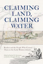
Claiming Land, Claiming Water shares what historians and geographers wish readers knew about maps and borders before, during, and after the founding of the United States. The essays collected in this volume model how people can learn to interpret maps as arguments, rather than as historical facts, and to read maps for evidence of people and places that were elided, renamed, or destroyed.
Contributors travel through the sixteenth, seventeenth, eighteenth, and nineteenth centuries in the place known by many names: the Atlantic World; the North American continent; borderlands; and homelands. Onto this place where people exercised power over space by forging relationships, colonizers came and imagined borders onto maps. Featuring reproductions of twenty historical maps, the book takes readers through this era of immense disruption to teach them strategies for reading and interpreting these maps critically. Essays attend carefully to water alongside land and land alongside water in search of new interpretive avenues that reframe what we know about space, control, and sovereignty.
By using historical examples of people—farmers, fishers, hunters, religious leaders, colonial projectors, traders, sailors, soldiers, diplomats, and cartographers, it becomes possible to resist the temptation to impose modern geographical constructs backwards onto the histories we read, teach, and write. Claiming Land, Claiming Water investigates why some of these people imagined and made claims to bounded space, and how and why other people confounded and challenged those claims.
Contributors: Sarah Chute, Edward G. Gray, Kim M. Gruenwald, Rachel B. Herrmann, Christian J. Koot, Chad McCutchen, Jennifer Monroe McCutchen, John Morton, Paul Musselwhite, Charles Prior, Karen Rann, Jessica Choppin Roney, Samuel Truett, Harvey Amani Whitfield, Alex Zukas.

